The Beginning...
Since I have finally decided to try my hand at blogging I thought it would be appropriate to start at the beginning - my beginning, of course.
Sentinel, Oklahoma
I was born in the '50s in Sentinel, a small town in rural Washita County, Oklahoma. I was only about a year old when my family moved away, so I have only vague memories of a later drive-through family visit to the town when I was in elementary school intermingled with a few memories and stories my parents repeated to my siblings and I as we were growing up. I couldn't tell you what it looked like, but I remember driving by the house we had lived in and being told that the town's hospital where I was born had been closed down. I also remember my parents remarking that the town was not the same and appeared to be dying. They pointed to the town's red traffic light at the main intersection having been converted to flashing yellow as evidence of the town's demise.
Although I only lived in the state about a year, I have always thought of Oklahoma as my home state, and have generally accepted its cultural heritage as my own. I never learned the actual history of my birthplace, however, before now.
Washita County, Oklahoma
Washita County is comprised of about 1,000 square miles of rolling prairie land suitable for ranching and farming in western Oklahoma. The land, originally open to wandering tribes of Native Americans (most likely Comanche and Apache) was assigned to the Creek and Seminole peoples relocated to this area during the 1820s and 1830s with the creation of Indian Country. They were replaced, however, when more than 5 thousand square miles of western Oklahoma was designated reservation land for the Cheyenne and Arapaho relocated from Colorado in 1869. There was pressure from cattle ranchers for access to the land as well. In fact, the route of the Great Western Cattle Trail where thousands of Texas Longhorns were driven through on their way to Dodge City, Kansas went through Washita County lands.
 |
| Courtesy: E Taylor; rebelcherokee.labdiva.com |
In 1892 the Cheyenne-Arapaho Territory was finally opened to non-Indian land runners for settlement. (The first Oklahoma Territory land runs were opened in 1889). Many ethnic groups settled in the county including a large number of German Mennonites from Russia who created crimean wheat farming colonies primarily in the North Eastern quadrant. Wheat, cotton and cattle continue to form the economic base of the county to this day. For a brief time during and after World War II the military operated the Clinton-Sherman Air Station in Burns Flat.
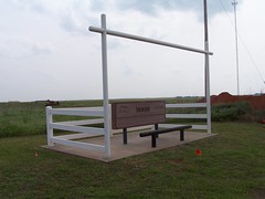
Sentinel, Oklahoma
My hometown covers only about .6 square miles on land in southwest Washita County. It sits at the intersection of state highways 44 and 55. As of the 2010 census there were 901 people living in Sentinel.
In 1899 a Post Office was established as Sentinel, Oklahoma Territory. (The town took its name from that of a nearby town's newspaper - the Herald-Sentinel!) A couple of years later the town's location was selected as one of the townsites for the new railway route and was named Barton on the rail company paperwork. After a local vote the name was officially designated Sentinel in 1907 and at the time of Oklahoma's statehood that same year the town listed 351 residents. By 1910, when the train tracks for the Atcheson, Topeca & Santa Fe line were complete the population had more than doubled to 857 people. In 1935 a Civilian Conservation Corps camp was built just west of town which boosted the population, however the number fell below 1,000 again by 1970.